Project History
Background
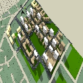
The Melrose Park precinct is on the eastern edge of the City of Parramatta Council Local Government Area (LGA) and is in the process of transforming from an industrial area to one that will provide for mixed use development including high density residential, open space, retail/commercial uses, and a new school. Planning for the redevelopment of this precinct began in 2016 when Council endorsed the Parramatta Employment Lands Strategy which identifies this precinct as being suitable for non-industrial development. As a result, Council has received Planning Proposal applications to rezone various sites within the precinct to allow non-industrial uses.
Amended Draft Planning Agreement
The proposed changes to the version previously exhibited in April/May 2021 relate to Section 8 of the draft Planning Agreement. It specifies that the development contributions rates applicable to the development are those contained within the Parramatta Section 94A Contributions Plan 20011 (Amendment No. 5) and not those within the recently adopted Parramatta (Outside CBD) Development Contributions Plan. The revised clauses include:
The exclusion of the application of Section 7.11 of the Environmental Planning and Assessment (EP&A) Act 1979 to the Development, but only to the extent that the Residential Gross Floor Area of the Development does not exceed 508,768 square metres.
The exclusion of the application of Section 7.12 of the Act to the Development, but only to the extent that the Residential Gross Floor Area of the Development does not exceed 508,768 square metres.
Sections 7.11 and 7.12 of the Act will apply to any residential floor area that exceeds 508,768 square metres
Minor clarification amendments have also been made to the Contributions Tables contained in Schedule 1 and Annexure B now refers to the Infrastructure Services Delivery Plan (ISDP) which is also attached to the Planning Agreement.
Previous Exhibition
To facilitate the change in uses, Council exhibited the Melrose Park North Planning Proposal, draft Site-Specific Development Control Plan (DCP) and Planning Agreement (PA now being re-exhibited).
- The Planning Proposal provides detail of the proposed changes to the planning controls on the site such as land use zones, building heights and floor space ratios.
- The draft DCP provides detailed planning and design guidelines such as floor space allocations across the site, open space requirements, building setbacks and stormwater management.
- The Planning Agreement makes provision for the delivery of community infrastructure needed to support the proposed redevelopment and has a value of over $96 million.
A summary of the proposed changes to the planning controls within the planning proposal area.
|
Payce Site 38-42. 44 & 44A Wharf Road and 27-29 Hughes Avenue |
Current |
Proposed |
|
Zone |
IN1 General Industrial R2 Low Density Residential |
R4 High Density Residential B2 Local Centre RE1 Public Recreation SP2 Infrastructure (Educational Establishment) |
|
Height |
12m |
2-24 storeys |
|
Floor Space Ratio (FSR) |
1:1 |
1.81:1 (gross) |
|
Ermington Gospel Trust Site 15-19 Hughes Avenue & 655 Victoria Road |
Current |
Proposed |
|
Zone |
IN1 General Industrial SP1 Special Activities (Place of Public Worship) |
R4 High Density Residential RE1 Public Recreation |
|
Height |
9m & 12m |
8 storeys |
|
Floor Space Ratio (FSR) |
1:1 |
1.85:1 |
|
8 Wharf Road |
Current |
Proposed |
|
Zone |
IN1 General Industrial |
R4 High Density Residential RE1 Public Recreation |
|
Height |
12m |
6-8 storeys |
|
Floor Space Ratio (FSR) |
1:1 |
1.85:1 (gross) |
Deicrop & Sekisui will also be entering into a separate Planning Agreement with the NSW State Government to help fund and deliver State infrastructure items. This agreement is being coordinated by the NSW State Governmet and will be exhibited by them at a later date.
A summary of the local Planning Agreement with Payce is in the Exhibition Material section.


