Melrose Park North

Frequently Asked Questions

Yes.

Approximately five (5) hectares of new public open space is proposed to be provided on the site (20% of the overall site area).

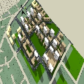
This includes a new central park north of the town centre, a new playing field and open space along the eastern and western edges of the precinct. These spaces will provide for a range of passive and active recreational uses.

A new school site is proposed in the precinct on the corner of Wharf Road and Hope Street which will accommodate approximately 1,000 students.

The new school is being delivered as part of the Planning Agreement between the developer and the State Government which will be subject to a separate consultation period run by the State Government at a later date.

Parramatta Light Rail Stage 2 is the responsibility of the State government and at present it is uncertain as to whether light rail will come to Melrose Park.

Council will continue to seek clarification from Transport for NSW and provide information as available.

A planning proposal (also known as a rezoning application) is a document that explains proposed changes to land use planning controls that are found in a Local Environmental Plan (LEP)*.

A planning proposal details how the controls are proposed to change, for example by increasing building heights or floor space ratios to allow for more development in a particular area.

It also sets out the justification for why these changes are suitable for the site and an assessment of the potential impacts of the proposal and how they should be resolved, if it is approved. Planning proposals are usually supported by extensive technical information to help with the assessment such as studies on flooding, traffic, urban design, and social impact assessments.

A planning proposal can be prepared by anyone, but usually it is either a landowner, developer, or Council.

*A local environmental plan (LEP) is a legal document that guides planning decisions by local governments. It is prepared by Council and approved by the State Government. The LEP is an important planning tool that helps shape the future of our area and ensures development is done appropriately. Controls in an LEP include such things as land use zones, building heights, floor space ratios, flood risk management controls and also heritage protections.

A “Development Control Plan” (DCP) is a planning document that provides detailed planning and design rules to support the Local Environmental Plan (LEP). These rules are often referred to as ‘controls’ and includes standards such as storm water drainage, landscaping, parking, access, urban design.

For significant planning proposals such as Melrose Park, a Site-Specific DCP is usually prepared to ensure the controls are tailored to the specific needs of the site.

A “Planning Agreement” is a legal document that is created under the Environmental Planning & Assessment Act 1979 between developers and government agencies (including councils) for the provision of funds or works by the developer for infrastructure, services, or other public amenities.

A planning agreement enables the opportunity for councils to negotiate much needed community facilities and infrastructure which could not be obtained through a development contributions plan*. Planning agreements are a more flexible mechanism to fund or deliver infrastructure to an area and can be tailored to the specific needs of where redevelopment is proposed.

* Development contributions plans enable councils to charge fees on new development in order to help fund new and upgraded infrastructure which will be required as a result of additional demand coming from more residents, workers and visitors.

This Planning Proposal, draft DCP and Planning Agreement apply to properties in the northern Melrose Park precinct where Council has received a planning proposal application.

If the properties along Hughes Avenue, for example, wish to redevelop then they would need to lodge separate planning proposal applications with Council, which has not been done.

There is no requirement for landowners to lodge a planning proposal with Council if they do not wish to change the planning controls on their property even if neighbouring landowners have done so.

For the properties not part of this exhibition, the planning controls currently applicable to these sites will be unchanged. Should the planning controls wish to be changed in future then separate planning proposal applications will need to be lodged with Council for assessment. You can find out more about the current planning controls that apply to your property by checking the Parramatta LEP 2011 or DCP 2011 or through here.

Approximately 5,500 new units could be constructed as part of this proposal.

This will be refined as part of the Development Application (DA) process.

Building heights up to 90 metres (approximately 24 storeys) are proposed in some locations within the site. These taller buildings are concentrated in the centre of the site and taper down to 6-8 storeys on the perimeter of the site.

Building heights have been distributed across the site so each development lot contains a range of building heights. Careful urban design testing has been undertaken for the precinct to minimise impacts on other buildings within the site and existing residential development adjacent to the site. More detail on the proposed buildings heights can be found in the draft DCP.

Public exhibition of these planning documents has now concluded.